Valley of the Ten Peaks
This past summer, myself and Seth had a fine adventure following the iconic skyline nicely outlined on the old twenty dollar bills, as seen from the in vogue #morainelake. Thanks to the increasing popularity of social media, the parking situation during the summer of 2022 was challenging at best. It was not uncommon for the parking lot to be completely full twenty-four hours a day as was the situation when we pulled up to a tired parking attendant at four in the morning, only to be informed the parking was indeed, full. Fortunately, with some smooth talking we were able to access a small pullout located a few kilometers down the road from the lake.

After downing the few drips of coffee remaining, we started our walk towards Wenchemna Pass where we would be able to gain the north ridge of Neptuak. Our goal for the day was to start with Neptuak and continue along the ridge until we reached Bowlen. It is important to note the traditional names for the valley of the Ten Peaks summits were simply referred to as the numerals from one to ten in the Stoney First Nations language. The then secluded Valley of the Ten Peaks was part of their original homeland. Starting with Mount Fay and working north the original names of these peaks were Heejee, Num, Yamnee, Tonsa, Sapta, Shappee, Shagowa, Shakhnowa, Neptuak and Wenkchemna.
Early morning light in the Valley of the Ten Peaks
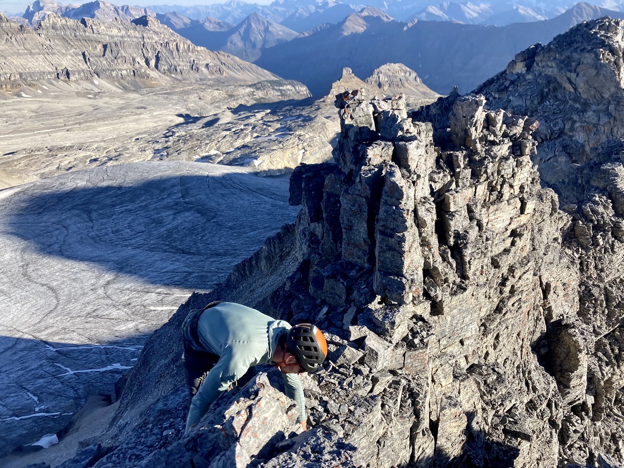
The walk up the trail to Wenchemna pass cruised by as the sun slowly started to illuminate the valley. After a leisurely interlude filling up water bottles we soon gained the north ridge of Neptuak. Lower down on the ridge we found excellent steep scrambling which led us onto to lower angle slopes up to where the ridge begins to kick back again. We picked our way through the steeper sections, at times finding perfect hand cracks in the solid quartzite. After gaining the summit, we dropped down to huge flat col before starting our way up the northwest ridge of Deltaform. More enjoyable scrambling/climbing soon had us on the high summit of Deltaform where we had our best views yet of what was to come.
Views from the summit of Neptuak
The quality and overall ‘fun’ level of Neptuak and Deltaform exceeded our expectations and had us feeling optimistic about what was to come. We made our made down to the Deltaform-Tuzo col with mostly via down climbing and a few raps on existing anchors. From here we started to grind up the west ridge of Tuzo. The west ridge is mostly steep scree with a bit of fourth class terrain thrown in on some extremely loose rock.
A brief interlude at the Deltaform-Tuzo col to discuss the importance of zippers
The descent down Tuzo was rather unpleasant to say the least. As the perennial snowpack continues to disappear with each summer that comes and goes, there are many portions of freshly exposed rock. This rock that has been recently revealed is often remarkably loose and unstable. Many of the original routes up these peaks often followed snow/ice slopes making for relatively safe and straightforward travel. Now, these routes can be fairly dangerous and not very enjoyable as you’re constantly perched on loose rocks ready to exfoliate themselves at the first opportunity.

Seth pointing out our future destination from the summit of Tuzo, looking towards Allan
Up to this point, we had intended to take what was supposed to be a nice couloir containing snow up the northwest aspect of Allen. Sadly, the snow no longer appeared to exist and instead it looked like more insecure scrambling on choss. Although choss in of itself can be enjoyable, we were starting to reach our maximum allowable uptake for the day. Instead of going for the more direct northwest ridge of Allen, we headed for the west slopes. The west slopes delivered straightforward scrambling up loose, rotten rock to the summit.

Views from the summit of Allen looking east where large swaths of bedrock are now exposed as the glacier recedes
The descent down the east ridge of Allen involved a few rappels with some existing anchors and others we left behind. Having the largest of the peaks behind us felt great as we were through the most complex of the terrain. The views east of Allen were incredible. Massive plains of exposed bedrock revealed themselves where former glaciers once existed. Looking out towards Prospector Valley, which leads towards Highway 93 south, the magnitude of these now extinct glaciers is brought into perspective.
Seth rigging one of the anchors we would use to rappel the east ridge of Allen
From the Allen-Perren col, we enjoyed a nice break where we could refill our water bottles with fresh melt off the glacier. Ascending Perren involved more of the now typical 4th-ish class terrain up fractured rock. From Perren we made our way over to Tonsa, which had some nice steeper climbing up low 5th class terrain near it’s summit. Descending the same way we came up for the first few hundred meters, we soon could drop down onto the glacier proper. This would lead us over to Bowlen. Bowlen is a quick scramble up a well trodden path.
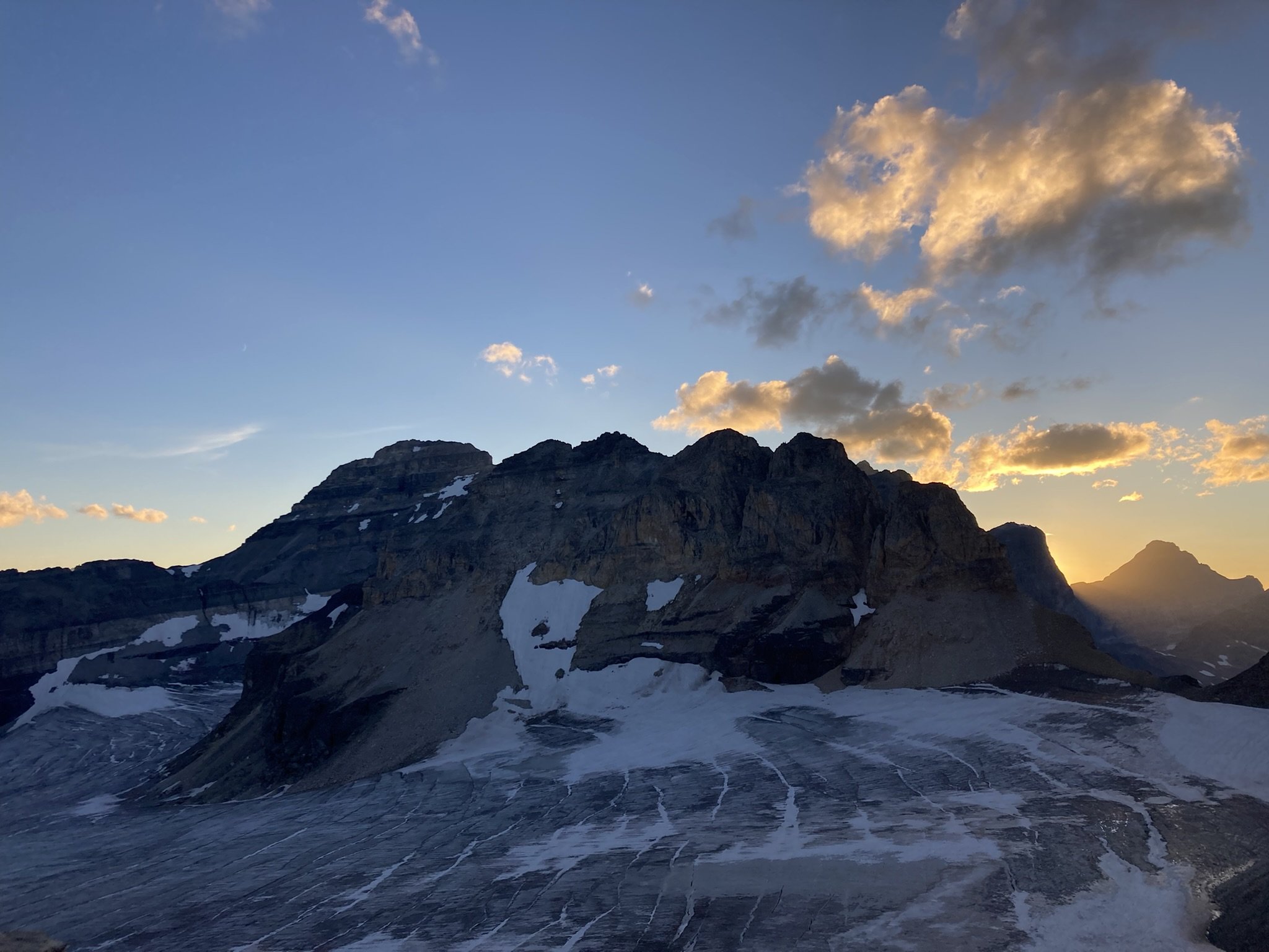
Looking back towards Allen, Perren and Tonsa as the sun is going down from Bowlen
After reaching up the top of Bowlen, we made our way down to the Neil Colgan hut located just below Mount Little. Considering the incredible weather, we were somewhat surprised to find the hut completely empty. I found this comical as not too far away, there were no doubt masses of people all staying within ear shot of there vehicles at Moraine Lake vying to get their pictures of the lake but not willing to venture any further. After no deliberation at all, we kicked back and enjoyed some hot coffee, courtesy of Starbucks instant French Roast, while taking in the last rays of the sun before darkness would set in.

Seth already reminiscing on the good times had on these fine chunks of rock
After a leisurely break, we felt nice and refreshed. Gaining the top of the of the well used Perren route was a little more challenging than normal as it was late in year and navigating some of the large crevasses in the dark kept us on our toes. Soon our toes would be soaked as the lower part of the glacier was composed of a thick layer of slush. Descending the Perren route was enjoyable as even in the dark it was easy to navigate back down to the valley. Walking the road the back to the car under a sky full of bright stars we were pleased with our adventure.
Down we go!
Flyby of our route courtesy of FATMAP